Government pasture
Forest service horses grazing near Red's Meadow

Red's Meadow Resort consists of a pack station, a small cafe, a small store, and a few small 11'x14' cabins. I hadn't been there in a decade, and yet it was exactly as I remembered. There is a little piece of lawn between the store and the cafe, a pay phone, and some sections of logs you can sit on. It is where you find all the backpackers who have just come in from long trips in the wilderness, who are enjoying ice cold beers and sodas and Gatorade and ice cream and, if they are really long distance hikers, maybe picking up cached food and mail. We got that Gatorade we'd been craving. And then some sodas.

And, sitting on the hitching post, drinking our gatorade, who should come sauntering up across the parking lot?

The cowboys.

We were old friends by that point. Said our Howdys.

It turns out it was Saturday (we had reckoned Sunday!) and apparently Red's Meadow hosts a barbecue every Saturday at six in the evening. We eagerly signed up for that night's BBQ. 20 bucks for all the ribs, tri-tip, chicken, corn, bread, salad, potatoes, cobbler, and other fixings you want. It sounded like a deal.


Red's Meadow bath house, photo by flickr user surfingcat

In the meantime we wandered over to the campground where a bathhouse was built decades ago at the site of a hot spring, providing hot spring showers to eager campers.

Refreshed by our shower, we set out again for the BBQ. On the way we struck up a conversation with some hikers who had just finished a hike all the way from Yosemite who invited us to camp with them at the walk-in campground. We almost put our packs down there but thought, "Who knows what will come up?" (Maybe we'll camp with the cowboys again?) We took a back trail back to the resort, put our packs down, and set about enjoying the BBQ.

We picked a table with some friendly looking folks. "Mind if we join you?" Turned out they were not fellow tourists but employees of the resort / pack station.

Enjoying the Red's Meadow BBQ Enjoying the Red's Meadow BBQ

We ended up sitting at that table long into the night in the company of several employees and the cowboys enjoying whiskey and a seemingly endless supply of Sierra Nevada. One of the employees in particular befriended us, and invited us to spend the night in his cabin. In the morning our new friend, Dave, treated us to breakfast at the cafe. We stayed so long talking we nearly got lunch too. Then we threw our packs into Dave's truck and he gave us a lift the mile or two to the postpile.

Breakfast with Dave at the Red's Meadow cafe Getting a ride to the postpile

After a brief visit to the postpile itself, we boarded the shuttle bus up to Minaret summit (where we paid a $14 'transportation fee' to leave the park) and then to the Mammoth Mountain ski area, a sort of hellish staging area for boisterously corporate Outdoor Activities.

There is a free shuttle bus from mammoth mountain down to the town of Mammoth, and from there there is a free Mammoth trolley that would take us most of the way to the trailhead where we had parked our car. But we were impatient and opted to stick out our thumbs while waiting for the bus. First car we saw, we put out our thumbs, and it pulled right over. Retired couple from Nevada cheerfully drove us all the way to our car at the Duck Pass trailhead. And then we drove back to Los Angeles.

A pretty fine trip:
* wilderness hiking
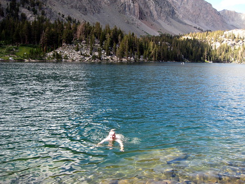
* swimming in lakes and rivers every day
* hot springs
* cowboys with steaks and whiskey
* BBQ
* impromptu couchsurfing
* hitchhiking
* ...

Hiking itinerary:
SegmentDistanceClimb/descent
Duck lake trailhead to Pika lake5 miles1700 ft climb
Duck lake to Purple Lake to Iva Bell Hot Springs14.5 miles3350 ft descent
Iva Bell to Cold Ck7 miles800 ft descent, 1000 ft climb
Cold Ck to Red's Meadow6 milespretty flat
33 miles
Our fourth day of hiking was short. Almost immediately we entered the area burned in 1992 by the "Rainbow fire," a desolate area of dense underbrush and the trunks of trees whose crowns were burned up in the fire. Tacked to one such trunk we spotted a metal sign, "N.P.S. BOUNDARY." Devil's postpile, the home stretch!

Rainbow Falls fire damage

We reached Rainbow Falls and encountered hordes and hordes of people wearing city clothes, talking on cell phones, many with small dogs. We had been in the wilderness for only a short time, but even so the crowds provided an unpleasant shock. I've carefully cropped them out of this photo:

Rainbow Falls

Leaving Rainbow Falls, the crowds subsided again as we walked the last mile into the Red's Meadow pack station. I can only imagine what PCT thru-hikers feel when they get to this sign:

Arrival at Red's Meadow

w00t!
Here are a few more photos from the trip I took a few weeks ago. On the third day, we hiked up out of the Fish Creek valley (where we were at the trip's lowest elevation, 6340 feet), a thousand feet up onto a sort of ridge on the side of the valley of the middle fork of the San Joaquin river. In this first picture we see the middle fork of the San Joaquin river leaving out to the West:

Middle fork of the San Joaquin river

From the same point looking North, we see Mammoth Mountain (bald in the upper right of the photo) in the distance. Our destination, Devil's Postpile / Red's Meadow, is just under Mammoth mountain:

Looking north towards Devil's Postpile

We camped somewhere near the trees seen after the prominant outcropping in this photo, just after crossing Cold Creek, in an overused but very convenient campsite. We heard what might have been a bear come crashing through the woods around midnight. I yelled at it and we didn't hear from it again. Bear or isolated tree falling down?

Along the way, we saw rock formations looking more and more postpile-esque; the rock formed from lava that cooled into hexagonal columns:

Postpile-esque formations

(Procrastination project: write a program to simulate cooling lava / evaporating mud and see if hexagonal jointing arises.)

Click on the 'Current Location' for this entry, and choose "Terrain" view in Google Maps to get an awesome view of the topography of the place; you'll understand immediately what you're looking at in the first two photos. To the south you'll find a long east-west valley with Iva Bell hotsprings at its eastern end; and north of that you'll find Duck Lake.

water

Aug. 17th, 2008 12:36 am
Mountain stream

One topic on the trail is how to treat water; on our first day we passed at least one dayhiker who mused, "I remember when you could drink the water in the streams...." Surface water in the Sierras is now assumed to contain various microorganisms (such as the protozoa Giardia and Cryptosporidium) that are apt to make people sick. To be safe your choices are to pump your water through a filter; to boil it for a few minutes; or to use iodine tablets. All of these options are a little bit annoying; a filter is another thing to carry and takes time to use; boiling requires a large amount of fuel and results in hot water; and iodine has a funny taste and may not be completely effective. We carried and generally used a filter.

But of course the cowboys didn't. After leaving their camp and coming to this stream coming off a high ridge with no trails, we were inspired to forgo the tedious filtering process and instead just fill our bottles directly from the stream.

The article "Giardia Lamblia and Giardiasis With Particular Attention to the Sierra Nevada" by a fellow physicist from U.C. Berkeley provides an interesting discussion of the mountain water quality situation, alleging that the Giardia scare is way overblown.

Anyway, so far so good.
The cowboys all retired to their bedrolls (the gear I had seen strewn about), watertight denim envelopes containing warm bedding, and we returned to ours: down sleeping bags laid out over our tent, which we did not bother to set up.

cowboy breakfast: jalapeno and coffee
Jalapeño and coffee

The cowboys were as much intrigued by our gear (tiny butane stove, water filter pump) as we were by theirs (bone-gripped pistols, a section of railroad rail as a makeshift anvil). We were very much enamored of them, of course. For one, I have never felt so under-dressed in camp. For another, the way they talked, always addressing each other by first name:

"Dee, pass the cheese please."
"Here you are, Ron."

Looking with dismay at our cranberries and sunflower seeds, they offered us tri-tip for the road.

horses
Horses enjoying 'feed' (cowboy speak for vegetation of any kind?)

Reluctantly we bid farewell and began our day's hike down the trail, still aglow from the amazing hospitality we'd unexpectedly received from this generous band of cowboys.

But before loading up our packs, of course we had to check out the hot springs for which we had come to this spot. During the long hike the day before I had feared the hot springs might be nothing more than a mosquito-filled mud pit, but instead we found what must be the most beautiful hotsprings I have yet encountered, high up on a hillside, with a panoramic view down the entire valley to the West. It looked something like this:

Iva Bell hot springs
We made a leisurely departure from our campsite between Pika and Duck lakes, then hiked back up to the trail and around the lake to its outlet, where the lake's stream cascades through meadows and down into the valley below. Here we got our first peek at Cascade Valley, something like 2000 feet below.

img_0220.jpg
Bree looking southwest from near the outlet of Duck Lake, elev. 10500 feet

Here we had a choice to make: take the John Muir Trail / Pacific Crest Trail directly to Red's Meadow (by Devil's Postpile National Monument), only 11 miles; or commit to a much longer trek that would take us to the Iva Bell Hot Springs. By the time we reached the junction, we were feeling energetic and ready to go, and so we veered to the left, on the trail towards Purple Lake, committing to the longer trip, and a very long day's hike: 14 miles to the hot spring!

Now we saw no more day hikers (many of whom had populated the trail up to Duck lake, almost all of them, inexplicably, with little pet dogs). Instead we encountered only the occasional backpacker or pack train. With them we had conversations like:

"How long you been out for?"
(wild eyed response) "Since May!"

Backpacks by Purple Lake

Of course we went swimming. (But only for a minute—it's cold!)

Swimming in purple lake
Swimming in Purple Lake, elev. 9928 feet.

From Purple Lake we began the plunge into the valley below. The trail drops nearly two thousand feet in three miles—I'd dread having to hike in the other direction!—ending at a creekside meadow.

We were already worn out from the descent, but determined to continue onward to the hot springs, motivated both by the alure of observing the Perseid meteors from a steamy pool and the desire of shortening the next day's hike. Besides, what else do we have to do?

From the meadow the trail is relatively flat, following the creek which plunges over cascade after cascade. The light was fading, though, and now we spent little time admiring the scenery. Already tired, we had six and a half miles to go!

In the fading twilight we began to climb up out of the river valley and then another thousand-foot descent into the next valley over. At the summit we felt relief: here a flashlight, there a campfire, twinkling lights in the wilderness indicated others camping at our destination in the distance. It was now without question night, but the quarter moon provided sufficient illumination enough to cast shadows, and, for the most part, hike.

"Wouldn't it be great if we could share their campfire," one of us commented to the other about the flickering orange star in the distance below.

At long last the trail flattened out and entered the dark cover of forest. Almost immediately we gave up the idea of finding the hot springs that night in the dark and instead set about finding a good place to camp. A few more minutes down the trail we again saw the flickering glow of that campfire. As we neared, we heard a friendly shout: "Howdy!" We approached.

"Know any good places to camp around here?"
"Yes I do, how about you join us right here!" The reply, exuding friendliness, was exactly as we had hoped.

And so we strolled into the campsite, the dark forms of gear and horses and people coming into focus as our eyes adjusted and the veil of mystery over a foreign campsite in the darkness evaporated. There were strewn about various pieces gear, I assumed something for the horses. There was a campfire equipped with grill and some food grilling on it.

"Hungry?"
"Yes," I answered.
"Hey Ron, throw on a few more steaks for our guests!"

I cannot describe the surrealness of this scene. Somehow, effortlessly, we had become guests of a party of honest-to-God cowboys who were right then sawing off a steak from a huge piece of beef.

"Are you folks drinking folks?"
"We are."
"Well grab a cup and let me pour you some bourbon!"

cowboys!
Cowboys Dee, Jay, and Chris; and us. Near Iva Bell hot springs. Elev 7140 feet.

duck lake

Aug. 13th, 2008 05:57 pm
On the next night of our trip, we camped at Duck Lake. The whole place was just superlatively beautiful; the photos hardly do it justice. Here's the lake (of course we went swimming!):

Duck lake

There's a little lake a few feet higher than Duck lake and right next to it, called Pika lake. Here's Bree next to the stream that goes from Pika lake to Duck lake, on a trail through a pretty alpine meadow.

Bree between Pika and Duck lakes

There's a great area to camp between the two lakes, which is where we setup our campsite:

Duck lake campsite
We camped the first night at Coldwater campground, located near the end of the Lake Mary road out of Mammoth, right next to the Duck Pass trailhead.

Coldwater was typical car camping at a popular spot, with all 77 campsites filling up by nightfall, almost everyone with huge RV's, dogs, generators, etc, a scene that is at once very much familiar but also perplexing: A couple hundred people gather in a small area of land to "get away from it all," bringing as many comforts from home as possible, all having separate campfires, and trying to pretend the other campers don't exist. One can't help but think that it's a culturally significant activity. How is camping different in other countries? We were more interested in meeting other people, and I pondered the notion of a campsite pot-luck, or at least a communal campfire. Also: at $19/night, the Inyo National Forest campsites cost more to rent than my apartment!

In the morning we broke camp, ate a big breakfast/lunch, and drove up to the trailhead. Here we are:

Me & Bree at the Duck Pass trailhead

The hike from the Coldwater trailhead up to Duck Lake is short (~5 miles) and up hill, climbing from 9000 feet to the pass at 10800 feet, then dropping down to Duck and Pika lakes at 10500 feet.

Always associated with backpacking, at least for me, has been an obsession with food, driven both by exertion and the knowledge that you'll be subsisting on rather minimal fixings for the next several days.

"Let me know when you start thinking about food. I'm already daydreaming about eating some ribs!" I told Bree.

The hiker is rewarded immediately upon departing the trailhead by the alpine lakes Arrowhead, Skelton, Red, and Barney. We were fresh, so the the thousand-foot climb to the pass went quickly. From there, looking back, we saw this:

View from Duck Pass

March 2020

S M T W T F S
1234567
891011121314
15 161718192021
22232425262728
293031    

Style Credit

Syndicate

RSS Atom
Page generated Aug. 12th, 2025 05:38 am
Powered by Dreamwidth Studios

Expand Cut Tags

No cut tags

Most Popular Tags